There is no single live page that tells you the Karakoram Highway road status for the whole 887 km Pakistani section, and anyone promising one is guessing. What you can do is combine three things: official weather and hazard warnings (the Pakistan Meteorological Department and NDMA), same-day reports from the district and road authorities along the route, and a trip plan that assumes a blockage is possible. On the KKH, a landslide can hold traffic for a few hours or for several days, and nobody can tell you in advance which one you will get.
So the useful question is not “is the road open right now?” but “what will I do at each point if it is not?” This guide turns that into rules: where to look, which months and sections carry the most risk, how many buffer days to hold, where the go/no-go decisions sit, and what happens to a booked car and driver when the N-35 shuts in front of you.
The short version for anyone booking a northern journey
- Treat every KKH timing as conditional and plan the drive as legs, with a check before each one.
- Hold spare days in both directions between late June and early October, with one protecting the flight home.
- Agree the “road shut” rules before you travel: waiting time, a driver’s overnight, a reroute, or a return short of the destination.
Karakoram Highway road status: which sources to trust, and for what
The KKH (National Highway N-35) runs from Hasan Abdal through Abbottabad, Mansehra, Besham, Dasu, Chilas, Gilgit and Hunza to the Khunjerab Pass on the Chinese border, according to the route summary maintained on Wikipedia. It crosses Punjab, Khyber Pakhtunkhwa and Gilgit-Baltistan and a string of districts, each with its own administration, which is why road information arrives in fragments. Each source below answers a different question.
| Source | What it is good for | What it will not tell you |
|---|---|---|
| Pakistan Meteorological Department (PMD) forecasts | Whether heavy rain or snow is expected over the northern areas in the coming days | Whether a specific section is blocked now |
| PMD Flood Forecasting Division bulletins | River levels and flood advisories on the Indus and its tributaries | Local nullah floods or rockfall on the road itself |
| NDMA weather advisories and monsoon situation reports | Area-wide hazard warnings and, after an event, reported damage | Real-time clearance progress |
| District administration and police statements, reported by Dawn, The Express Tribune, Arab News and others | Where a blockage is, which side traffic is stuck, and whether an alternative exists | How long clearance will take (estimates often move) |
| UK FCDO travel advice (and similar government advice) | Standing risks for foreign visitors, including landslides and seasonal road closures | Day-to-day road status |
| Your driver’s own network along the route | What drivers coming the other way saw an hour ago | Anything official; treat it as a lead to confirm |
The PMD website carries the national forecasts and seasonal outlooks, and its Flood Forecasting Division publishes flood bulletins and advisories for the main rivers, including the Indus that the KKH shadows for much of its length. The National Disaster Management Authority publishes weather advisories through its National Emergency Operations Centre, keeps an archive of monsoon situation reports, and lists a 24/7 emergency helpline (051-111-157-157 at the time of writing; confirm it on the NDMA site before you rely on it).
The UK government’s FCDO safety and security advice for Pakistan says landslides frequently block or destroy roads, that some roads in Gilgit-Baltistan (it names the N15 between Chilas and Babusar) are inaccessible at certain times of year, and recommends experienced local drivers and travel only in clear weather. It also points travellers to PMD forecasts. That is sensible advice, and it is the baseline this guide builds on.
How to read a “KKH road update today” post
Much of what circulates as a kkh road update today is a forwarded video with no date. Before changing plans, check:
- Date and time. Clips of a blocked road resurface for days after it reopens.
- Exact place. A blockage in Upper Hunza does not stop you reaching Chilas; one near Dasu might.
- Who said it. A deputy commissioner or police statement carried by a newspaper outranks an anonymous group message.
- Vehicle type. Ask whether light vehicles have a diversion even if trucks do not.
The weather calendar: monsoon, winter and the passes that change the arithmetic
Northern road risk follows the seasons closely enough to plan around, even if you cannot predict individual days.
Monsoon: late June to early October
The FCDO describes Pakistan’s monsoon as usually running from late June to early October, with a risk of flooding and landslides. On the KKH, heavy monsoon rain is what turns steep cut slopes into rockfall and mud across the carriageway, and a blockage can last hours or longer. The 2025 season is a recent reminder: Arab News reported in August 2025 that floods had blocked the Karakoram Highway in Upper Hunza along with several other roads in Gilgit-Baltistan.
The road may be open for most of the season, but the chance of losing a day somewhere on a round trip is real, and it often lands on the return leg.
Winter: snow, cold and shorter days
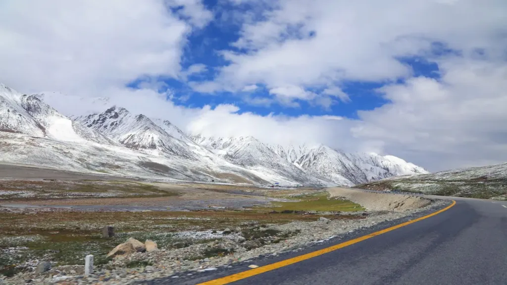
Winter brings a different set of constraints. Snow and ice matter most at altitude, and the Khunjerab end of the road reaches 4,714 m. Daylight is short, which limits how far a careful driver will go in one day on mountain sections. Heavy winter snow has historically shut parts of the highway for extended periods.
One change worth knowing: the Khunjerab border crossing used to open only from 1 April to 30 November. Dawn reported in April 2025 that, under an agreement between Pakistan and China, the pass now operates year-round. That concerns the border post; it does not mean every stretch of road below it is snow-free on any given day.
Spring: western disturbances
Spring is not automatically calm. Western weather systems can bring heavy rain and snow to the north-west and the mountains. In April 2026, for example, NDMA posted an advisory for a westerly wave approaching north-west Pakistan, with a flash-flood warning for Khyber Pakhtunkhwa and Balochistan. Earlier that month, Arab News reported that Khyber Pakhtunkhwa’s disaster management authority had warned of landslides and flash floods in districts that included Upper and Lower Kohistan. The lower KKH runs through Mansehra, Battagram, Besham and Kohistan’s Dasu, so such warnings matter well before you reach Gilgit-Baltistan.
Babusar: the shortcut that is only sometimes there
The Babusar Road (N-15) links Naran in the Kaghan Valley with Chilas, rejoining the KKH there. When it is open, it can save a great deal of time. Dawn’s report on its reopening in May 2025 after a seven-month closure put the journey between Diamer and Mansehra at around seven hours via Babusar against about fourteen via the KKH, and noted that the pass, at about 13,700 feet, is usually closed by snow from November until June, with NHA crews clearing snow from more than 21 glaciers between Naran and Babusar Top before reopening.
That makes Babusar a seasonal variable, not a fixed alternative. If your plan relies on it, check that it has actually reopened that year, and have a KKH-only timing ready. Our guide to when Babusar Top and the KKH open and close covers that route choice in more detail.
Where the road tends to stop: Chilas, Gilgit and the Hunza stretches
People searching for a chilas road condition today or a gilgit road update are usually trying to answer one practical question: can I get past the next town before dark? A few features of the route explain why these names come up so often.
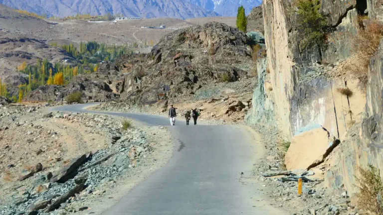
- The Indus gorge between Besham and Chilas. Through Pattan and Dasu the road is cut into steep valley sides above the river. Any cut slope can shed rock after heavy rain, and between towns there are few places where a stuck vehicle can wait in comfort.
- Chilas and the Babusar junction. Chilas is where traffic from Babusar rejoins the KKH, so conditions there affect both routes. It is also a natural overnight stop, which makes it a good decision point.
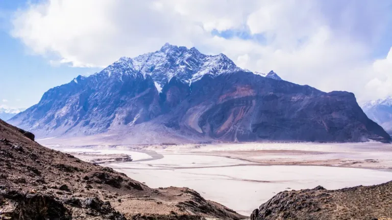
- Gilgit to Hunza. North of Gilgit the road climbs through Nagar and Hunza. This section was reshaped by the January 2010 Attabad landslide, which dammed the Hunza River and created Attabad Lake; a bypass with five tunnels and several bridges reopened the through route in 2015.
- Upper Hunza towards Sost and Khunjerab. Remote, high and, as the August 2025 floods showed, vulnerable when glacier-fed streams run high.
How long does clearance take?
There is no published standard, and it would be misleading to give you one. A small slip on a single carriageway may be pushed aside by machinery within hours. A large slide, a washed-out culvert or a damaged bridge can take days, and repeated rain can undo a morning’s work by the afternoon. What you can realistically plan for:
- A blockage of a few hours: absorbed by an early start and a flexible lunch stop.
- A blockage lasting the day: absorbed by one buffer day, if you are stopped in a town with somewhere to sleep.
- A multi-day closure: requires a decision to wait, reroute or return, and possibly to rebook flights.
Closures that have nothing to do with weather
A karakoram highway closed landslide headline is the most common kind, but not the only one. In January 2025, Arab News reported that a sit-in over power outages at Aliabad in Hunza had kept the KKH shut for four consecutive days. Hunza’s deputy commissioner said trucks and containers were stuck on both sides, while an alternative route existed for smaller vehicles. Two lessons follow: always ask whether light vehicles have a way through, and include local news, not only weather, in your final check.
Buffer days and decision points: a planning framework
The figures below are iDrive planning guidance, not official rules. They reflect a simple principle: the cost of an unused spare day is small and known; the cost of a missed international flight is large and not.
| Travel window | Main risk | Suggested buffer on a round trip to Hunza | Plan B worth pricing |
|---|---|---|---|
| Late June to early October (monsoon) | Landslides, flash floods, bridge damage | 2 days minimum; 3 if your onward flight is long-haul | Standby day in Chilas or Gilgit; return via Babusar if open |
| Mid-October to November | Early snow at altitude, shorter days | 1 to 2 days | Earlier daily start times; KKH-only timing if Babusar has closed |
| December to February | Snow, ice, cold starts, limited daylight | 2 days, with conservative daily distances | Flying one leg if schedules and weather allow |
| March to mid-June | Western disturbances, spring rain, snowmelt | 1 to 2 days | Holding in Islamabad until a warning passes |
Put buffers where they protect the fixed points, and keep them genuinely free: a “spare” day filled with a Khunjerab excursion is not a spare day.
The five decision points
- Three days before departure. Read the PMD forecast for the northern areas and any NDMA advisory. If significant rain is forecast along the route, decide now whether to shift the whole trip by a day or two, while hotels and vehicles can still be moved.
- The evening before. Check the latest newspaper reports for the route and ask the driver what colleagues on the road are seeing. Agree the start time; on mountain legs, an early start buys the most daylight to absorb a delay.
- Departure morning. A last check. If a closure is confirmed ahead and clearance is not expected that day, it is usually better to wait where you are than to drive to the queue.
- Besham or Chilas. These are the natural mid-route checkpoints. Here the question is concrete: can you reach the next safe overnight stop before dark? If not, stop.
- Before the return leg. Repeat the three-day check, working backwards from your flight. If the forecast looks poor, leave the north a day early and spend the buffer in Islamabad, close to the airport.
A driver who knows the route is the best single tool at points 3 and 4. The FCDO’s advice to use experienced local drivers and travel only in clear weather is really an instruction about who makes these calls and on what basis. It also affects which vehicle you choose; our note on choosing a car for the northern areas covers ground clearance, luggage and comfort on long mountain days.
A worked example
Example only, to show the method. A family flying out of Islamabad on a Saturday evening in August plans five nights in Hunza. Without buffers, they would drive down on Saturday morning. With the framework above, they leave Hunza on Thursday, reach Chilas or the Babusar side that night depending on conditions, arrive in Islamabad on Friday, and hold Saturday as the protected day. If the road shuts on Thursday, they still have one day in hand.
For the full route, including the drive stages and vehicle options, see our Islamabad to Hunza car with driver service. If Skardu is in your plan, the trade-offs between road and air are laid out in Islamabad to Skardu: fly or drive; northern flights are themselves weather-dependent, so they are a plan B, not a guarantee.
What happens to a booking if the road shuts
A road closure is nobody’s fault, but it still has costs: a driver and vehicle held for extra days, meals and a room for the driver, extra fuel for a longer route, and sometimes a return without reaching the destination. The practical risk for a traveller is not the closure; it is discovering on the day that nobody agreed who pays for what.
With iDrive, a northern journey starts as a request. Operations review the route and dates, and a booking is only in place once it has been confirmed; vehicle type and availability depend on what is confirmed for your dates. A road closure does not change that basis, and any change to a confirmed trip, such as extra days or a new route, is agreed as a change rather than assumed. That is why it helps to settle the “road shut” rules at quote stage.
What to agree before you travel
- Waiting time. How standby hours or days are charged if the vehicle is held at a blockage or in a town.
- Driver overnight costs. Who arranges and pays for the driver’s accommodation and meals on unplanned nights.
- Reroutes. How a longer alternative (for example, KKH instead of Babusar) is priced if the planned route closes.
- Turning back. What happens if the group decides not to continue: the return leg, and any unused portion.
- Contact rules. Coverage can be patchy in the mountains, so agree a message at each checkpoint and who decides if the traveller cannot be reached.
Also check whether your travel insurance covers extra nights and rebooked flights caused by road closures or natural events.
If the road shuts while you are already on it
In a queue at the blockage, ask the driver to find out from police or other drivers whether the obstruction is being actively cleared and whether light vehicles are being let through. If clearance is not expected before late afternoon, turning back to the last town with food and rooms usually beats waiting among trucks after dark. Keep water, snacks, warm layers and medication in the cabin, not the boot. If you are already at your destination with the return cut, the flight becomes the fixed point: work out the latest departure from the north that still makes it with a margin, and treat that as your deadline for rebooking.
Families travelling with older relatives or small children should add rest stops to every timing, not only the delayed ones. Our sister service Pakistan Taxi, which runs on the iDrive network, has a practical note on asking for breaks and stops on an intercity journey that applies well to long mountain days.
Next step: send the route with its buffers built in
When you request a northern journey, give the operations team the whole plan rather than the headline route: your dates, the fixed points (flights, events), the buffer days you intend to hold, whether Babusar is part of the plan, and how many people and bags are travelling. That lets the team review the route and discuss realistic stages, standby terms and a KKH-only fallback before anything is confirmed. You can start that request on the iDrive booking page.
Questions people ask
Is there an official live map of Karakoram Highway road status?
Not one that covers every section in real time. Use PMD and NDMA for hazard warnings, newspaper reports of district and police statements for specific blockages, and a driver who is in touch with others on the route.
How long does a KKH landslide usually take to clear?
There is no fixed figure. Small slips can clear within hours; large slides, washed-out sections or bridge damage can take days. Plan for a lost day rather than trying to predict the exact duration.
Is Babusar Pass an alternative when the KKH is blocked?
Only in season, and only for blockages south of Chilas, where the two routes meet. Babusar is normally closed by snow for much of the year, so check that it has reopened before counting on it.
How many spare days should I keep for a Hunza trip in the monsoon?
As a planning rule, at least two across the round trip, with one immediately before any international flight. Add a third if your flight home is long-haul and hard to change.